
News Summary
Memphis residents are bracing for severe thunderstorms and high temperatures this weekend as the National Weather Service issues a Level 2 storm threat. Isolated storms are forecasted for the morning with highs near 89°F, while humidity will make it feel like 100°F. A significant chance of intermittent rain and potential flash flooding raises concerns. Residents are advised to stay informed and take precautions against the extreme weather conditions as the weekend approaches.
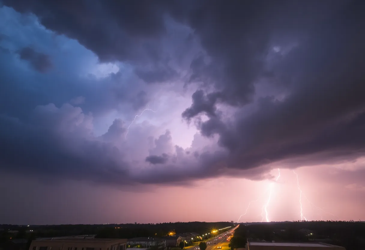
Severe Thunderstorms Expected Across Memphis as Heat Advisory Looms This Weekend
Memphis residents should brace for severe thunderstorms and high temperatures as a heat advisory is anticipated this weekend. Isolated thunderstorms are forecasted for the morning, transitioning to partly cloudy skies in the afternoon, with highs expected to reach 89°F. However, humidity levels will push the ‘feels-like’ temperature close to 100°F.
The National Weather Service has issued a Level 2 out of 5 threat for strong to severe storms late Wednesday afternoon and into the evening. Winds will be blowing from the south-southwest at speeds ranging from 15 to 25 mph, with occasional gusts exceeding 40 mph, contributing to potential storm intensity.
A 30% chance of rain is predicted for the afternoon, starting around 4 PM, with scattered thunderstorms anticipated to develop in the evening, becoming more widespread overnight. As nighttime falls, the low temperature is expected to hover around 71°F, with winds shifting to the southwest at speeds of 10 to 15 mph.
Rainfall is set to intensify, with a 90% chance of precipitation during the evening. Total rainfall amounts may exceed one inch, raising concerns for flash flooding. Residents are urged to remain vigilant due to the potential storm activity.
Weekend Outlook: Heat Advisory Possible
The beginning of the weekend holds a challenging weather pattern as a heat advisory may be necessary. Forecasts indicate that temperatures will soar into the low to mid 90s, with the humid conditions making it feel even hotter, likely surpassing 100°F. The combination of high heat and humidity is expected to dominate over the upcoming days.
Despite a brief chance for rain on Thursday, conditions will primarily be defined by the rising temperatures as Memorial Day weekend approaches. On Monday, the chance for showers and thunderstorms will return with a 30% likelihood for precipitation, extending the period of potentially severe weather.
Monitoring Weather Conditions
The incoming thunderstorms could pose risks not only from strong winds but also from heavy rainfall that can lead to flooding. Local authorities and the National Weather Service recommend taking any weather alerts seriously and being prepared for rapidly changing conditions.
In summary, Memphis is set to experience a turbulent weather pattern with severe thunderstorms expected today, followed by a weekend marked by extreme heat. Residents should remain aware of the conditions and prepare accordingly as weather events unfold.
Deeper Dive: News & Info About This Topic
HERE Resources
Police Chase from Mississippi Ends in Memphis Arrest
Memphis Man Arrested for Attempted Murder
Husband and Wife Arrested After Northeast Memphis Bar Shooting
Memphis Braces for Heavy Thunderstorms This Morning
Memphis Schools Prepare for Father’s Day Weekend Events
Memphis Schools Face Allegations of Document Destruction
Rising Violence in Memphis: Recent Shootings Alarm Residents
Severe Thunderstorms Cause Power Outages and Bonnaroo Cancellation
Three Men Detained After Shooting in Southwest Memphis
Quinn Mathews Leads Memphis Redbirds to Victory with Complete Game
Additional Resources
- Fox 13 Memphis: Morning Rain and Thunder
- WBTV: Severe Thunderstorm Warning Issued
- Hoodline: Memphis Braces for Mixed Bag of Weather
- Fox 13 Memphis: Strong Storms Possible
- Google Search: Memphis Weather

Author: STAFF HERE MEMPHIS WRITER
The MEMPHIS STAFF WRITER represents the experienced team at HEREMemphis.com, your go-to source for actionable local news and information in Memphis, Shelby County, and beyond. Specializing in "news you can use," we cover essential topics like product reviews for personal and business needs, local business directories, politics, real estate trends, neighborhood insights, and state news affecting the area—with deep expertise drawn from years of dedicated reporting and strong community input, including local press releases and business updates. We deliver top reporting on high-value events such as Beale Street Music Festival, Elvis Week, and Memphis in May International Festival. Our coverage extends to key organizations like the Greater Memphis Chamber and the Memphis Convention & Visitors Bureau, plus leading businesses in logistics, healthcare, and music that power the local economy such as FedEx, St. Jude Children's Research Hospital, and AutoZone. As part of the broader HERE network, including HEREBristol.com, HEREChattanooga.com, HEREKnoxville.com, and HERENashville.com, we provide comprehensive, credible insights into Tennessee's dynamic landscape.